

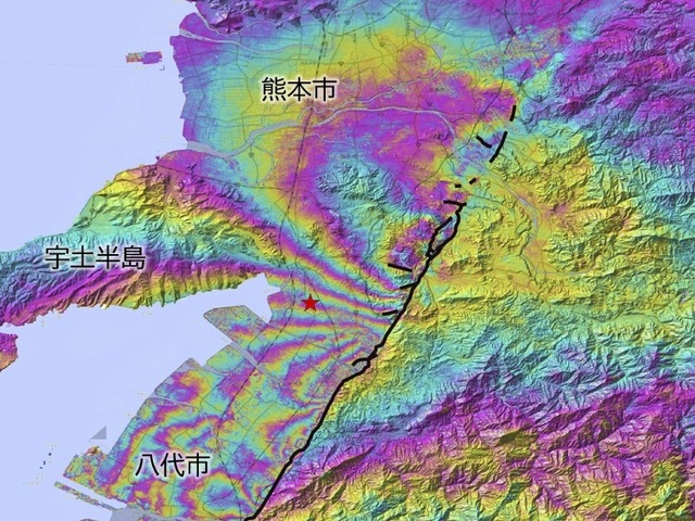
熊本地震、約35kmにわたって地表にずれJAXAのレーダー衛星「だいち2号・4号」で観測
On August 5, the Geospatial Information Authority of Japan announced that it had interpreted the boundaries (displacement boundaries) of the surface shift caused by the Reiwa 8 Kumamoto Earthquake.
- 公開日
- レベル
- N1+
On August 5, the Geospatial Information Authority of Japan announced that it had interpreted the boundaries (displacement boundaries) of the surface shift caused by the Reiwa 8 Kumamoto Earthquake.
0:000:00