

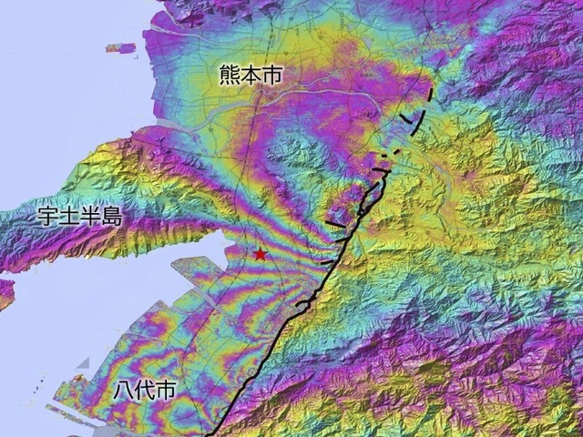
Kumamoto Earthquake: surface displacement observed over about 35 km by JAXA's radar satellites Daichi-2 and Daichi-4
On August 5, the Geospatial Information Authority of Japan announced that it had interpreted the boundaries (displacement boundaries) of the surface shift caused by the Reiwa 8 Kumamoto Earthquake.
- Published
- Level
- N1+
On August 5, the Geospatial Information Authority of Japan announced that it had interpreted the boundaries (displacement boundaries) of the surface shift caused by the Reiwa 8 Kumamoto Earthquake.
0:000:00